
By: Shannon F.
Slaughter
The
Land Court issued a decision in October (the “Decision”), after holding a bench
trial to determine the ownership of the area between the mean high water mark
(the line of the "upland") and
As
Judge Long noted in the Decision: “precisely who owns the marsh, and where, is highly significant. For the Wolpes, Mr.
Atkins, and Mr. Weltman, owning (or not owning)
the marshland directly abutting their vacation houses is the difference between
having waterfront homes with full access and rights to the waterside, and homes
with no such rights. For [SN] Trust—which, in addition to its mainland claims,
is the owner of Gooseberry Island just offshore— it is the difference between
being able to build a house on that Island and not being able to do so, because
only by owning the strip on the mainland at the end of Punkhorn Point Road will
it have a place from which to construct a connecting bridge.”
The
first task presented to the Court was determination of the record owner(s) of
the marshlands in question. This required the Court and the parties to travel
back in time to the late 1800s. A number of legislative acts in the late 1800s authorized
the Barnstable Superior Court to appoint three Commissioners to make set-offs
of certain land in Mashpee that was owned communally by the Mashpee (formerly
known as Marshpee) Wompanoag Tribe. The set-offs by the Commissioners allowed
individual members of the Tribe to own the parcels individually.
The first lands legislatively
authorized to be set-off were uplands. A map of the uplands was created in 1877
by one of the Commissioners, Cyrus Cahoon, who was a surveyor (the “1877 Map”).
Several years after the uplands were set-off, the legislature granted the same
three Commissioners the authority to set-off marshlands. Both the upland and
marshland set-offs were confirmed by orders of the Barnstable Superior Court.
Thus, the Land Court’s analysis of the true record owner of the marshlands in
question began with the set-offs in the late 1800s and the Court disregarded
any subsequent deeds or plans that could not be traced back to the original
set-offs as land grabs.
The marshlands in question involved
three specific marshland set-offs: (1) “Old
Division Lot 16,” located on the mainland, was partitioned to members of the
Pocknet family; (2) “Old Division Lot 17,” located partially on the mainland
and the remainder surrounding Gooseberry Island, was partitioned to the Coombs
family; and (3) “Old Division Lot 18,” located on the mainland, was partitioned
to the Mingo family. It was undisputed at trial that the Plaintiffs own record
title to the majority of Old Division Lot 16, Defendant owns record title to
Old Division Lot 17, and the Town owns title to Old Division Lot 18.
Unlike the 1877 Map of the uplands, a
map of these marsh set-offs could not be located (although the Court found that
such a map was likely created
contemporaneously with the marsh set-offs). Thus, the second task presented to
the Court was to determine where Old Division Lots 16, 17 and 18 are presently
located on the ground. In order to do so, the Court analyzed the specific
descriptions used by the Commissioners in the marsh set-offs, which he found
were “carefully chosen references in
light of (1) the commissioners' awareness of the Legislature's command that the
set-offs be "properly describe[d] ... in writing," (2) their
professional occupations (one a surveyor, another an attorney) that accustomed
them to the need and practice of clear and precise language when drafting, and
(3) their knowledge that the setoffs would be reviewed and ultimately approved
by the Barnstable Superior Court, where clarity was essential.”
Critically,
the Old Division Lot 16 marsh set-off was described as being bounded to the
west by the “upland of the Homestead Lot of Elijah W. Pocknet" (the
location of which was shown on the 1877 Map) and bounded on the east by the Mashpee
River. In contrast, the Old Division Lot 17 marsh set-off was bounded on
the west by "upland belonging to Elijah W. Pocknet" (the
location of which was shown on the 1877 Map) and bounded on the east by Popponesset
Bay. Finally, the Old Division Lot 18 set-off was described as being
bounded on the west by "land belonging to Elijah W. Pocknet,"
and bounded on the east by Ockway Bay. The distinctions in these
descriptions were critical in the Court’s determination that Old Division Lot
17 (owned by SN Trust) was located adjacent to the Wolpe Upland and the
Atkins/Weltman Upland and extended south of Punkhorn Point Road.
Having
determined that SN Trust owned the marshes at issue, the final issue presented
to the Court was determination of whether Plaintiffs established adverse
possession or adverse possession by color of title to the marshlands. To
succeed on an adverse possession by color of title claim, a claimant must prove
the following: (1) the claimant's deed must facially include the land adversely
claimed, (2) the deed must be recorded and have been on record for twenty
years or more prior
to the filing of the lawsuit or other interruption of the claim (the
"adverse possession period"),
(3) the claimant must have actually, openly, notoriously, exclusively, and
adversely possessed at least a part of
the land for that continuous, uninterrupted twenty years, and (4) if the
claimant's own deed and acts of adverse
possession are insufficient to meet
the twentyyear period, he may "tack" onto the deeds and
adverse acts of his predecessors in title during that period if (a) there
was no interruption between
their deeds and adverse
acts and his, and (b) their deeds were also recorded
and included the land.
See Dow v. Dow, 243 Mass. 587, 590 (1923); Nantucket, 271 Mass. 62, 68 (1930); Norton v. West, 8 Mass. App. Ct. 348, 351-352 (1979); Long v. Wickett, 50 Mass.
App. Ct. 380, 382 n.3 (2000).
The
adverse possession standard applicable to wild and uncultivated lands applied
to Plaintiffs’ claims of adverse possession given the nature of the marshlands
and a "pronounced" and continuous occupation was needed in order to
prove their claims. Peck v. Bigelow, 34 Mass. App. Ct. 551, 556 (1993). Like
all cases involving adverse possession, the Court’s analysis was fact specific:
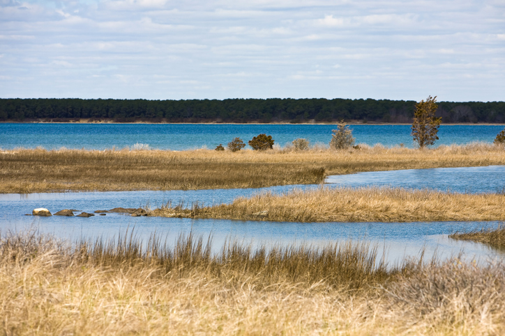
The land at issue “is salt marsh, covered in tall grass, deep mud, and
completely under water at high tide. It is unsuitable for use as a beach (too silted and
muddy) and, so far as the record shows, has never been used as a beach or for
any recreational purpose other than fishing or crabbing. People do not walk on
it idly or for pleasure. During the entirety of the view, which took place at
mid-day, the area in front of the plaintiffs' homes was muddy, under water, and
un-walkable. […] [A]ny activities on it, of any kind, were few and far between.
It was not a place for use.
Rather, it was something that was looked at, and which viewers looked over, as they watched sunrises, bird
migrations, and boats in Popponesset Bay.”
The
Court found that Atkins/Weltman failed to establish adverse possession or
adverse possession by color of title over any portion of the marsh. The Wolpes,
however, gained adverse possession over an area where their predecessors
constructed a wooden walkway, which is in the same location where the Wolpe’s current
dock is located. This wooden walkway was constructed sometime in the 1950’s and
went into disrepair in the 1980s. The construction and maintenance of this
walkway, the Court found, was such a pronounced occupation to constitute
adverse possession over the marshlands and the Wolpe’s predecessors used the
wooden walkway openly, notorious, adversely and continuously for at least
twenty years.
The
wooden walkway did not support the Wolpe’s claim of adverse possession
by color of title. The wooden walkway began on the Wolpe upland and extended
over the marsh adjacent to the Atkins/Weltman Upland, not the marsh
adjacent to the Wolpe Upland that they were claiming under the theory of
adverse possession by color of title. Therefore, the plans of record on which
the Wolpes relied to claim ownership of the marsh adjacent to the Wolpe Upland did
not include any portion of the marsh that had actually been adversely
possessed—only the area where the wooden walkway was located (the marsh
adjacent to the Atkins/Weltman Upland) was adversely possessed. Therefore, the
Court held that the Wolpes had adverse possession of the area over which the
wooden walkway was located (where the Wolpes’ dock now stands), but not to any
other portion of the marshlands at issue.
Notably,
the Court noted that there was testimony regarding children walking along the
neighboring upland and occasionally going into the marsh to play, but those
activities could not establish adverse possession as use by children, alone,
cannot reasonably be seen as associated with a claim of ownership. “[N]o
reasonable view of adverse possession considers young children, playing on
their own, to be either adverse claimants or agents of such claimants whom a
landowner is forced to chase away on peril of losing his land. The law is many
things, but it does not require people to be mean to children. Children fall
into the category of those to whom implied permission is deemed to have been
given.” The children did not stay long in the marsh. They did not build
anything there. They were interested in exploring for fish, marine life, and
the like, all of which were within their public rights to do under the Colonial
Ordinance. In other words, marsh-ing around by children who were playing by
themselves cannot support a claim of adverse possession.

Shannon Slaughter,
a partner at Dalton & Finegold LLP, tried the foregoing cases, Land Court
Docket Nos. 14 MISC. 487495 and 14 MISC. 486868 (KCL), in 2017 with Edward
Englander of Englander and Chicoine, P.C. Shannon Slaughter’s practice focuses resolving real estate and
land use disputes, including real estate acquisition and complex title
litigation, prescriptive easements and adverse possession claims, determination
of ownership of tidelands, zoning and subdivision litigation, construction
defects, fraudulent title and conveyances, and condominium disputes. She
can be reached by email at sslaughter@dfllp.com.